
What about the Ocean beneath the Ship?
Satellite data are truly amazing for ocean science – yet the majority of what we can see from satellites in space is a signal limited to the very surface layer of the ocean. Physical and biogeochemical interactions between oceans and atmosphere involve several key processes governing the Earth system dynamics and its climate. Momentum, heat, gas exchanges and their fluxes between the ocean surface and the atmosphere boundary layer influence key components of the Earth system such as the ocean circulation, the Earth radiation budget, the global water cycle, global carbon cycle and the defining conditions necessary to maintain biodiversity, among others.
Satellite data are truly amazing for ocean science – yet the majority of what we can see from satellites in space is a signal limited to the very surface layer of the ocean. Physical and biogeochemical interactions between oceans and atmosphere involve several key processes governing the Earth system dynamics and its climate. Momentum, heat, gas exchanges and their fluxes between the ocean surface and the atmosphere boundary layer influence key components of the Earth system such as the ocean circulation, the Earth radiation budget, the global water cycle, global carbon cycle and the defining conditions necessary to maintain biodiversity, among others.
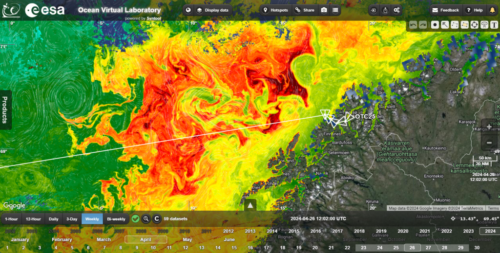
Chl-a (OC4ME) signals in the Norwegian Sea from Sentinel-3 Ocean and Land Colour Instrument (OLCI) on 29 April 2024)
Ocean Models – application while at sea!
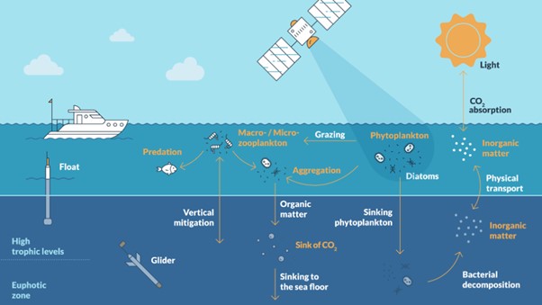
The combination of satellite measurements, in situ measurements and ocean model outputs forms the basis of ocean science. The satellite data give “the big picture”, the in-situ observations enable the surface signatures to be related to the vertical structure of the ocean (largely inaccessible from space at this time), and ocean models provide a means to bring all data together with theory and extract optimal knowledge of our ocean state – and forecast the ocean state for several days ahead.
(Courtesy of Copernicus Marine Service: https://marine.copernicus.eu/explainers/operational-oceanography/monitoring-forecasting/models/green-ocean)
An ocean model is a mathematical description of the ocean. It includes the familiar three dimensions, as well as its evolution over time; making it four dimensional (4D). Ocean models can be used to describe the ocean state in the past, present and future. Derived products are hindcasts (reanalyses), nowcasts (analyses), and forecasts (prediction of future states).
Ocean models, in situ and satellite observations are the main components of an ocean monitoring and forecasting system. Observational data (satellite and/or in situ) can be integrated into the numerical models to ensure they are as close to reality as possible. This process is called ‘data assimilation’. While the observations only represent a portion of the global ocean, models complete the missing information with realistic ocean dynamics to provide an overall picture.
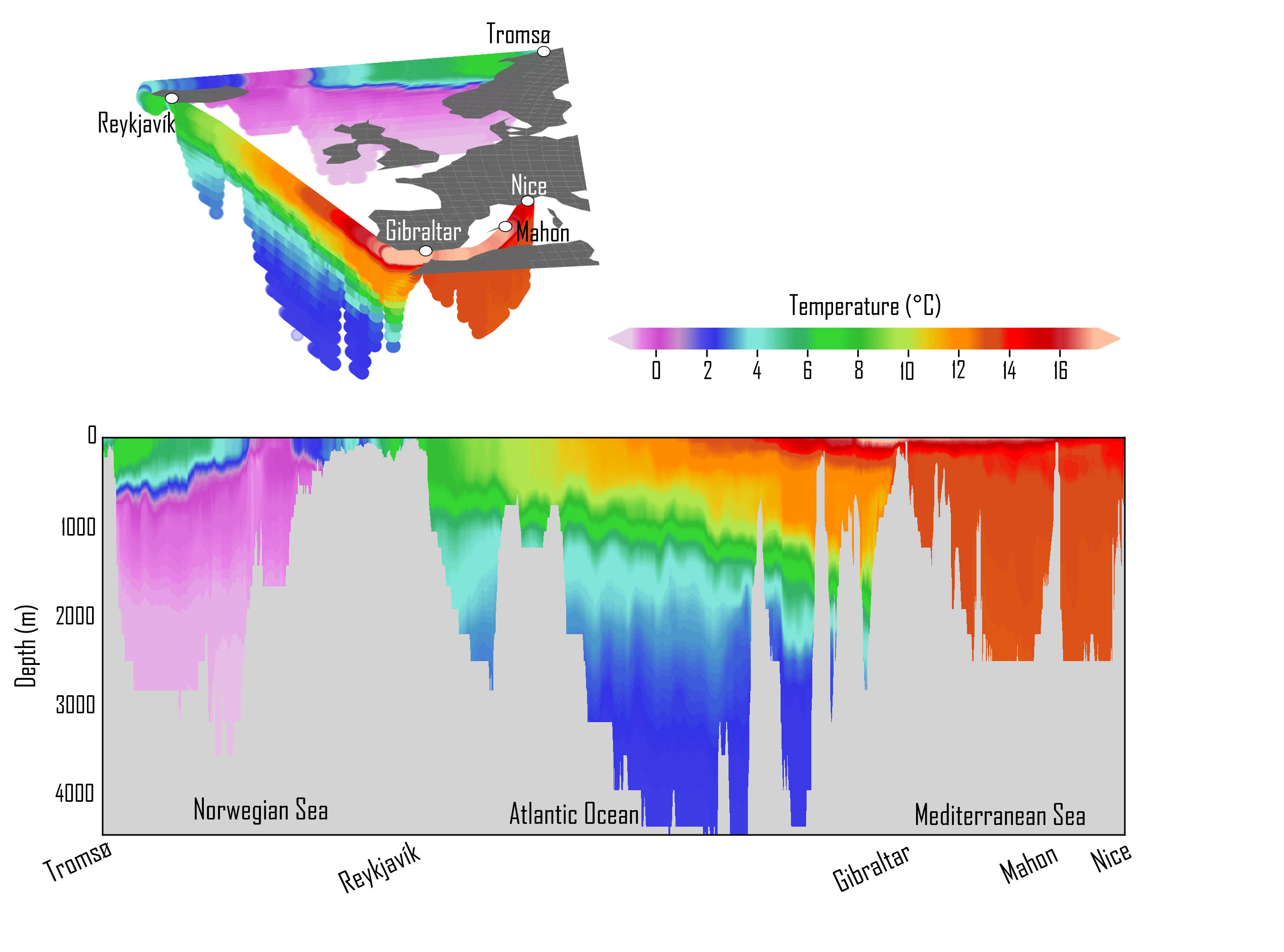
Vertical distribution of potential temperature (theta) along the planned track of the Statsraad Lehmkuhl during the #OTC25 voyage from Mercator global 1/12° analysis and forecast operational run highlighting the very different vertical stratification across the Norwegian sea, the North East Atlantic and the Mediterranean Sea (Credit Mercator Ocean/CMCES)
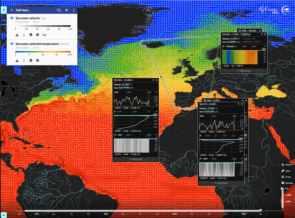
Source: Copernicus Marine MyOcean Viewer
Green Ocean models describe the basis of the marine food chain, by simulating the cycles of chemical elements, their interactions with the environment and their incorporation into living organisms (the first links of the food chain). They are driven by an ocean circulation model and represent the link between the physics of the oceans and the higher trophic levels of marine ecosystems.
Unlike the Blue Ocean, whose models are based on the Navier–Stokes equations, there are no fundamental laws to describe food chain dynamics, so Green Ocean models are based on empirical relationships. A multitude of biogeochemical models are available, depending on the scientific objectives and the study region. Green Ocean models rely on observational data to challenge model formulations. Find out more at the Copernicus Marine Service (CMEMS https://marine.copernicus.eu/explainers/operational-oceanography/monitoring-forecasting/models).
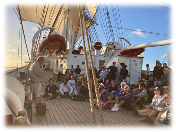
Making excellent Observations at sea – Fiducial Reference Measurements (FRM)
Satellite data are truly amazing for ocean science – yet the majority of what we can see from satellites in space is a signal limited to the very surface layer of the ocean. Physical and biogeochemical interactions between oceans and atmosphere involve several key processes governing the Earth system dynamics and its climate. Momentum, heat, gas exchanges and their fluxes between the ocean surface and the atmosphere boundary layer influence key components of the Earth system such as the ocean circulation, the Earth radiation budget, the global water cycle, global carbon cycle and the defining conditions necessary to maintain biodiversity, among others.
During the #OTC25, FRM methodologies will be explored both in theory and in practice to ensure the results we obtain are trustworthy and ready for applications that support European Policies such as the European Green Deal (https://commission.europa.eu/strategy-and-policy/priorities-2019-2024/european-green-deal_en). Guidance documentation and training materials available at www.qa4eo.org.. Further activities of the European Space Agency include FRM for Ocean Colour (https://frm4soc.org/), Sea Surface Temperature (https://ships4sst.org/ and http://www.frm4sts.org/, and satellite Altimetry https://www.frm4alt.eu/ amongst others)